Thursday, October 27, 2016

Sugarloaf Mountain

I'll let the pictures do the talking on this one, but it was a great time!  It felt more like a walk in the woods than a true hike, but with stunning views, so it was a win-win in terms of effort:reward ratio.

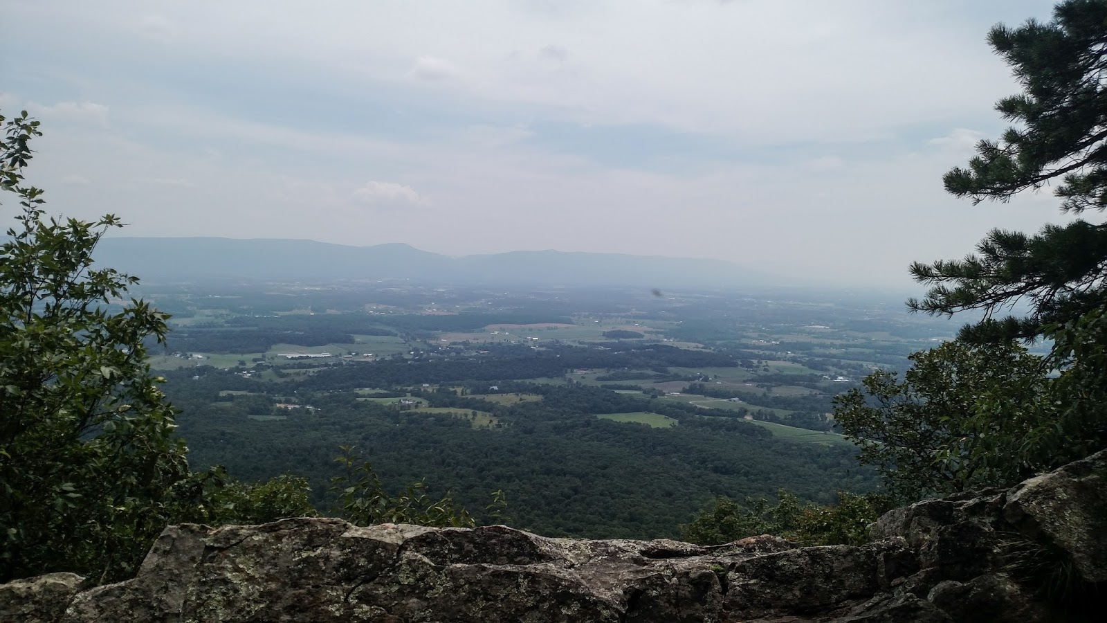
View at one of the overlooks

Casey and Stephanie on the rocks

Nothing beats a winery 10 minutes from the trailhead (Sugarloaf Mountain Winery)!

Wednesday, September 28, 2016

Three Ridges Loop

Suspension Bridge  
It had been too long since I had been backpacking.  I've been trying to find an opportunity for quite some time and I finally snagged my chance!  In a lucky stretch of unseasonably warm weather, Casey and I found the perfect weekend in late September to take ourselves away from the hustle and bustle of the DMV.  We headed to Three Ridges Wilderness in an attempt to do the Three Ridges Loop (see Hiking Upward).  We headed out early Friday morning with our bags packed and ready to go.  To make a long story short (because I'm exhausted after getting up before 4 a.m. this morning for an [ultimately failed] attempt to go on a hot air balloon ride), we decided to start at the alternative start coordinates.  We incorrectly figured that these coordinates would be for an overflow lot or something of that sort.  It turns out that the alternative parking is actually a 15 minute drive from the other parking lot. To visualize the loop trail, picture a sketch of a lollipop.  Now picture that lollipop with a stick poking out each end.  The end of one stick is one parking lot and the end of the other stick is the other parking lot.  Each branch off of the loop will get you to the loop, but from opposite directions.  However, while I do generally love HikingUpward as a resource, we realized fairly quickly into our hike from the alternative parking coordinates that there was zero indication of how much longer the "lollipop stick" of the trail to the loop from the alternative parking coordinates would be. (If you're wondering, the answer is about a mile longer each way - so a 16ish mile loop instead of a 14 mile loop).  We also realized about a mile into the hike that we had lost one of our large, 1 L water bottles.  Bottom line?  We opted to turn around, attempt to find our water bottle (guess who forgot to take it out of the car!?), and start again from the other parking coordinates.    While not the intended start to the day, we did get to check out a super neat suspension bridge that is close to the alternative start point.

One of the first overlooks
By the time we reached the other start point (the one that had detailed directions and distances), it was already early afternoon.  Pretty soon in, Casey realized that his pack was causing his shoulders to ache.  Casey's pack is a several decade old day-pack that places all of the weight-bearing load into the shoulder straps.  A new one is in the works, but alas, we are not made of money and so we hoped that the day-pack would be a suitable temporary stand-in.  In the end, it wasn't a good option.  We redistributed some of the weight into my pack and traded packs every so often as we climbed.  It wasn't ideal, but it was doable.  Because of the pack, the late start, and the quickly-realized knowledge that we both could stand to get in better backpacking shape, we opted to reach the best vista of the hike, hike to the next vista that was less than a mile away, camp there, and then backtrack the following day.  This plan saved us about 4 miles and while we didn't get to officially complete the loop, it was still a beautiful trip.  As an added bonus, we stumbled upon a mama bear and two cubs about 30 feet from the trail.  Mama bear scooted down the tree that she was in when she heard us on the trail, but left us alone as we made some noise and continued walking.
At the best overlook of the hike


Casey napping at the campsite.  Note to hikers - please do not take a dump right next to a cleared campsite.  Someone left a nasty pile of unburied crap + toilet paper right beside this rock  which was about 15 feet from the tent site (I photoshopped it out because it ruined the photo).  We covered it up with rocks so the next camper doesn't have to look at it.

Tent site!  Gorgeous weather.  Fly is "half up" to add some privacy right off trail, but it was too gorgeous of an evening to cover the tent up all the way.

Sunrise at the overlook

Sunrise at the overlook

Casey on the way back to the car

Friday, September 2, 2016

Billy Goat Trail Part A (again!)

I'm getting a bit tired of this trail lately, but then I really can't complain that such beautiful scenery is essentially in my backyard.  This time around I went with Casey and his younger cousins and we all had a blast.  Unfortunately, this hike also marked the last trip for my beloved boots.  I might be able to save them with some boot glue, but I managed to pull nearly the entire sole of the boot off of the "body" of the boot and had to tie the sole back on with paracord to finish the hike.  I shouldn't complain - the things lasted me over 11 years (albeit with only minor use until about 4 or 5 years ago).  But still, I'm sad to see them go and my wallet is cringing just a bit at the thought of needing to buy myself a new pair!  In any case, I'll just leave you with a few photos since I'm not really feeling the writing bug right now.


one of the first overlook points

A different view from the same overlook point
My poor boot has seen better days...

Wednesday, August 10, 2016

Difficult Run Trail/Old Carriage Road Loop

I caught up with an old friend to hike a loop incorporating the Difficult Run Trail and the Old Carriage Road on the Virginia side of Great Falls park.  The water was quite brown as you can see and the weather looked a bit threatening for a while, but it was a great trip overall and the weather held out!  We generally followed these directions: http://www.hikingupward.com/OVH/DifficultRun/.  However, instead of taking the Swamp Trail back, we took Old Carriage Road to the Ridge Trail to Wolfpack Trail to get back.  Our total loop was about 5 miles which incorporated the jaunt to the water and back on Difficult Run Trail at the beginning of the hike and an accidental failure to turn off of the Carriage Trail at the end of the hike (we accidentally hiked to the end of Old Carriage Road and then had to return to the junction with Ridge Trail).  For the proximity to UMD and the NoVa area, Great Falls is a must for anyone who enjoys exploring.  However, finding solitude in this area seems to be close to impossible.  As it was, even with thunder rolling in by the time we reached the picnic area, the area was bustling.  

Muddy river view from an overlook along the trail

Another muddy river view while the sky was still blue

View of the River Trail

Sunday, July 24, 2016

Kepler Overlook

The map at the trail head.  
Before this hike, I can't remember the last time that I went on a hike and did not see a single soul on the hike or even a car parked at the trail head.  Surprisingly, at less than two hours from DC, this hike delivered complete solitude.  And it was such a neat place!  It had three or four rudimentary car camping areas near the base of the trailhead and several more backpacking areas along the trail.  The car camping areas were still very much "backcountry" in that you're not going to find a bathroom or picnic table in the vicinity, but you can drive your car right into the spot and there are fire pits at each spot.  
I used HikingUpward as my navigation for this hike and found the directions to be generally good, but I would elaborate by saying that there are two "permanently closed gates."  The last car camping area is a turn off to the left, but the gate/fire road that you should follow is the one before the left turn off (i.e. straight ahead).  You'll notice a trail sign and map at the beginning of this fire road that are not present on the fire road closer to the camping area.  Take the fire road with the map!

first backpacking campgsite that you'll pass
Shortly after turning left onto the blue blazed trail, we crossed a dry creek bed and came across this neat backcountry camping area.  The rest of the trail to the top was fairly uneventful, but I loved how quiet it was!  At one point, a bunch of ants were crawling across the path and if you stopped, you could hear them scurrying across the leaves.  Overall, this hike was a win - gorgeous views at two points, and a great place to be if you want peace and quiet.


Rickety "bridge" across a creek.  Casey trusted it - I walked across the dry creek bed instead.

First overlook (you must go off trail to see this one).  At fourth switchback on the trail, there is an unmarked side trail that you can follow to this overlook.  Follow the side trail behind the back of a rock outcropping and you'll reach this view.

At the final overlook.  You'll see another unmarked side trail on the right from the top of the ridge that will bring you here.

The final view

Thursday, June 16, 2016

Maryland Heights and C&O Canal

Casey and I have been meaning to go backpacking for quite some time now, but schedules and weather keep getting in our way.  So, when we found a unplanned stretch of time from Thursday to Friday (with both of us off on Friday), I insisted that we try to make something happen.  Unfortunately, with the two of us now almost real adults, we realized that we wouldn't be able to depart until after work.  This might have been fine, except that after an extensive google search, I reached the conclusion that there is no good backpacking any closer than a 1.5 hour drive from College Park.

This would mean that in the best case scenario, we would have been able to arrive at the trailhead in the late afternoon to early evening.  For as much hiking as I have done, I have done very little true backpacking and was concerned about beginning a hike so close to dusk when we were both so new to securing food from bears, using our (new and improved and hopefully less prone to spontaneously burst into flames) camp stove, and just generally doing the overnight thing.  As such, we began to think about alternative options and wound up with the idea of taking ourselves on a bike camping trip along the C&O canal with a day hike to Maryland Heights the following day.  It turned out to be a perfect idea.

I had recently secured a free bike trailer off of Craigslist with the hope of being able to cart around my aging dog when she can no longer walk around Burke lake on her own four paws, but the trailer seemed like the perfect way to get our tent and supplies from point A to point B via bike.  It worked out just wonderfully.
bikes at the campground
We arrived to our starting point, the Antietam campground, around 7:00 p.m., ready to bike just about seven miles to the Huckleberry Hill campground.  The C&O canal is essentially flat and is well groomed so it was smooth and quick sailing.  There are campgrounds at frequent intervals along the trail, which makes this a perfect trail to do a long-distance bike ride along (I want to go back for a longer trip now!).  We arrived with nearly an hour of daylight to spare and met our friendly neighbors.  All of the others at the campground were on the trail for the long-haul - we were the only overnighters - and they were good company.

What a view to wake up to
 The next day we had been thinking about taking the bikes to the Maryland Heights trail head, but we were concerned about theft, so we opted to bike back to the car and then drive into the town of Harpers Ferry to start our hike there.  I don't have too much to report from the hike - it's a pretty steady uphill for most of the way with a roughly .5 mile downhill section right before the overlook.  The overlook is well worth the little hike.  You are able to see the confluence of the rivers, the town below, and know that you may be sitting in Maryland, but you are overlooking Virginia and West Virginia.  Such a neat place!

Casey at the overlook

Me at the overlook

One more of the beautiful view

Sunday, June 5, 2016

Billy Goat Trail Section A (Great Falls, MD)


pond along the trail
 It's about time that I'm getting around to adding the Billy Goat Trail!  I've done this trail a good four or five times and in my opinion it is the best hike inside of the Beltway.  It's popular, no doubt, but if you can put aside the crowds and just look at the scenery, you'll be wondering how it is that you are only a quick drive from DC.  Yesterday I went with Casey, Stephanie, and Josh after Casey and I had a bike camping trip stormed out on Friday afternoon.  It was busy as expected and we saw quite a few kayakers on the river and in the canal along with swarms of hikers.  It is understandable that this hike is popular, I suppose, because along with the great views and rock scrambling, it is short.  The hike itself totals only 1.7 miles (keeping in mind that it's a U-shaped hike, so you must either retrace your steps or follow the canal path back to the beginning of the hike).  Even still, at about 3.7 miles total if you take the trail to the canal path as a loop, it's a moderate hike at most.  But boy is it beautiful.

Stephanie and Josh

There's rocks like this for most of the way

Casey by the water

A neat little bridge over a rushing creek

Casey and Stephanie aren't thrilled at the photo opportunity