Friday, December 11, 2015

Devil's Marbleyard and Smith Mountain Lake State Park

This past Thanksgiving I finally had the chance to get outside again (may I mention that graduate school is consuming my life!?).  My family and I were at the lake for Thanksgiving and so I was back in the Southern part of Virginia and able to enjoy some quality outdoors time.  My family, Casey, and I enjoyed a trip to the State Park and I caught up with some college friends on a trip to the Devil's Marbleyard the next day.
Casey on a rock wall at Smith Mountain Lake State Park

Boo at Smith Mountain Lake State Park

Sneaking some photos through the trees of my friends at the marbleyard
I may have mentioned my last experience at the Devil's Marbleyard in which a boulder fell, plinko-style, down the marbleyard while I stood transfixed as I waited to see if it would stop before turning me into a human pancake.  Fortunately, that day was not destined to be my last, and the boulder finally wedged itself behind another boulder after an eternity-seeming several seconds.  This time around, my friends were set on returning to the marbleyard (they were not there to witness my near death boulder experience).  I was not about to turn down an opportunity to hike and socialize and so I tagged along with the plan to avoid the boulder field.  The trip from the lake made me long to return to the mountains.  Instead of following the route through Bedford and onto 81, we climbed up and over a mountain on some tight little back roads. Southwest VA, oh how I have missed you.

Another view of my friends on the boulders
When we finally arrived to the marbleyard, we met up with a friend's brother who had brought along his four month old puppy.  If you haven't been to the marbleyard, let me start by saying that it is not an ideal place for dogs.  The hike to the boulder field is just fine for your four-legged friends.  The boulder field, however, is far from an ideal playground for a dog (this is coming from someone who is generally all about bringing the dog on every possible excursion).  As it turned out, the fact that I was planning to avoid the marbleyard came in handy.  It took some convincing, but finally the friend's brother agreed to let me walk the puppy up the bushwhacked path along the side of the boulder field.  We would reconvene at the top.  I'm not exactly sure what his alternate plan was - perhaps to carry the dog on his shoulders?  That seemed like a disaster waiting to happen and so I was happy to take the dog.  Plus, a little company is never a bad thing.
Bailey the puppy on the way up the mountain

Bailey takes a break on the way up
Unfortunately, the dog had different ideas.  She was not thrilled to be left with a strange human in a strange place on the side of a mountain and so conveniently tried to drag me down the mountain each time I stepped on a particularly slippery rock or patch of leaves.  As such, the trip up the side trail was a full body workout - me dragging, carrying, and prodding the puppy along while trying to maintain my footing.  In the end, we made it to the top and the dog was a trooper, but it might have been best for her to have been left at home.  Regardless, it was an enjoyable time and I remember just how much I miss being in the rural areas of Virginia.

Sunday, September 13, 2015

Doyles River Falls

You may begin to notice a shift in the location and frequency of my hikes.  While I will always be a Hokie, I am no longer able to call Southwest Virginia my primary stomping grounds.  You may now call me a proud Hokie-Terp (I don't know if I could've made up a derpier sounding name).  And so, with Maryland as my new turf, hopefully you'll be able to follow me as I explore Northern Virginia and Maryland through my time in graduate school.  After that, who knows?

Regardless, I finally had the opportunity to hike again!  I did this one with Casey on the way from Southwest Virginia to Maryland and while I can't say that I loved it (the waterfalls weren't much more than a drip and it was crowded with a capital 'C'), it was so refreshing to be able to enjoy some fresh air on a crisp not-quite-summer-not-quite-fall day.  The trail was a steady downhill on the way to the falls and a steady uphill on the way back.  We passed quite a few small children who had made it to the falls just fine, but were not so keen on walking back up to the parking lot.  Casey and I practiced our trail jogging on the way down and slowly plodded our way back up.  It was enough of a workout for this newfound city girl to be sore for a few days after!  None-the-less, the hike as we did it was short (only 3.2 miles total as an out-and-back to and from the lower falls), so I wouldn't call it more than moderate in terms of difficulty level.

Casey beside the trail

Some people beside the nearly non-existent lower falls

Monday, July 6, 2015

Seattle Trip - Mount Ranier National Park, Olympic National Park, and Mount Si

 Seattle and the surrounding area screams "green!"  The city requires citizens to separate out compost from recycling from trash.  An intimidating sign on the trashcan of my sister's condo complex threatens to increase the HOA fees should compostable waste be found in the trash dumpster.  REI was founded there.  The grocery store charges you for every plastic or paper bag that you use.  There are parks everywhere including three national parks within a reasonable drive.  And it may be not be science, but it sure looked like the fitness outweighed the fatness of the passers-by that I noticed on my visit.  It seemed a natural place for hikers to convene.  And if it weren't so far away and traffic didn't terrify me (a by-product of learning to drive near DC?) I might just move there.

Recently, I was fortunate enough to visit my sister who has taken up residence in Seattle.  While there, we did some hiking, some wandering, and a whole lot of enjoying the beauty of nature. I will let the pictures speak for themselves.
View from Skyline Trail looking away from the summit of Mount Ranier (Mount Ranier National Park)

Mom and Jenny enjoying the hike
Mount Ranier via Skyline Trail

A snow tunnel at Mount Ranier

Snow covered trail on the Skyline loop (Mount Ranier)

Me and Casey at Panorama Point (Mount Ranier)

Wildflowers at Mount Ranier

Another shot from the Skyline Trail at Mount Ranier


Hurrican Ridge at Olympic National Park

Me and Jenny at Hurricane Ridge

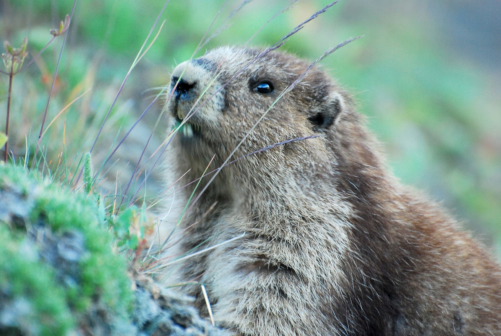
Marmot on hike near Hurricane Ridge Visitor Center

Ruby Beach (Olympic National Park)

Sol Duc Falls (Olympic National Park)

Deer at Hurricane Ridge (Olympic National Park)


Raven Rocks

I have no photos of this hike that Casey and I did in June and not really much to say for it.  That's not to say that it wasn't a good hike.  In fact, for a hike in the Northern Virginia area, it was reminiscent of those hikes surrounding Blacksburg.  As you can see graphically if you check out the hikingupward link to this hike, the trail does not merely ascend to a ridge with views.  Instead, it climbs and then descends and then climbs and then descends, and then finally climbs again.  I can't decide if I appreciate the intermixed ups and downs or if I prefer the more typical "up on the way there - down on the way back" hike.  Regardless, we had a nice time and met a few German folks who are doing a long section hike on the AT.  They commented on how lacking the flora and fauna identification skills seem to be of hikers in the area and then embarrassed us by quizzing us on our history knowledge when they asked if we knew how Washington D.C. got its name.  Born and raised not 30 minutes from the nation's capital, I was ashamed that I hadn't the faintest idea.  I have since looked up the answer and in case you are wondering, the name "Washington" is after George Washington (I could have guessed this much) and "Columbia" is after Christopher Columbus and was an old term used to describe America.  So there you have it - a hike and a history lesson in one.

Great Falls - Virginia

I am a bit behind on posting my hikes, but on June 13th, Casey, Kevin and I decided to hike the Billy Goat Trail section A.  I have done this hike numerous times before - albeit not in a few years - but with Casey as the driver and I as the co-pilot, it is easy to see how we ended up in the wrong spot.  When we arrived at the entrance to the park, it didn't look like my usual parking spot, but I assumed that we were merely in the legal parking zone.  Unlike where I typically park, this lot involved driving past a ranger station and paying an entrance fee (which was waived thanks to Casey's NPS volunteer pass).  Nevertheless, we parked and set to scanning the map which we had received at the entrance station.  When we couldn't find the Billy Goat trail on the map, Casey took himself back to the station to ask the ranger for some assistance.  According to the ranger, we were a hop, skip, and jump across the river from our intended destination.  With no bridges or boats to speak of, daylight slowly dying, and self preservation in mind, we opted to find some new trails on the Virginia side of the river.  While not quite as exciting as the rock scrambles on the Billy Goat, the trail proved to be a worthwhile expenditure of our time.  Plus, I saw a cool snake!

Casey and Kevin at the falls overlook

Baby snake near a launch
The falls in focus


Friday, May 29, 2015

Buzzard Rocks

Casey and I took a trip to Shenandoah State Park a few weekends ago and decided to find a short hike to do in the general area.  Because of the length, not-too-difficult difficulty level, and descriptions of pretty views, this one was the winner.  I wasn't disappointed!  In the interest of time, I'll just be adding photos today!

View from Buzzard Rocks
Casey at the rocks


Me enjoying the view

A little lizard guy that we found along the trail

Wednesday, April 22, 2015

Humpback Rocks, Spy Rock, and Sherando Lake

I was so excited to write my blog post last evening, but after an hour of updating my hikes list, I didn't find the time to write my narrative as well.  Today, that excitement is gone and the post feels a bit more like a chore.  Since I am fairly confident that I am the only person that actually reads my own blog posts anyway, I am going to let my photos do the narrating this time around.


Casey and I at the overlook rock in Sherando Lake Recreation Area.  You can't see it, but the lake is directly behind and below us.  Unfortunately, the trees block the view of the lake, so most of the view is just what can be seen here.


A snippet of the Sherando Lake trail

An interesting creature.  I don't know what species it is.  There were many of these around in a creek near the lake.

Humpback Rocks overlook
Spy Rock Overlook


A bit of the rock scramble up to the top of Spy Rock.  Casey had to give me a leg up the first little section because the rock was wet and slippery.
Me on Spy Rock